
Der Einkaufskorb ist noch leer.
|
Wales Coast Path 1 - Chester to Caernarfon 1:40 000 National Trail - HARVEY MAPS [Wales Coast Path 1 - National Trail Map]
|
Stöbern
|
<< Großbritannien: Wanderkarten, Radwanderkarten und MTB-Karten
<< Harvay Maps
|
|
 | |
Wales Coast Path 1 - Chester to Caernarfon 1:40 000 National Trail - HARVEY MAPS
Wales Coast Path 1 - National Trail Map
ISBN: 1851376607
Preis: EUR 23.90
(incl. MwSt.)
|
|
 Blattschnitt Blattschnitt
Beispiel
The Wales Coast Path is a 1400km (870 miles) long distance trail that follows, or runs close to, the entire coastline of Wales. It is an incredibly varied trail that offers rugged and unspoilt walking, colourful seaside villages, industrial archaeology, clifftops, beaches and unique heritage sites.
4 HARVEY maps cover the whole of the route (Maps 1 and 4 will be available May 2023). Each map covers a section of the Path suitable for about 2 weeks of walking.
Map 2 covers the Path from Caernarfon to Cardigan.
On this stretch, you will pass through the rugged and beautiful Llyn Peninsula, take in Cardigan Bay and its wide, expansive beaches and walk across the famous Barmouth Bridge.
|
|
Startseite
Allgemeine Geschäftsbedingungen
Kontakt
Impressum
|
|
Dieser Sitzball ...
... ist ein detaillierter Globus
Die Welt ist ein Geschenkpapier
Die Welt aus dem All
Dekorative Satellitenbild-Poster in gestochen scharfer Auflösung!
Riesengloben zum Aufpusten
So entdecken Kinder die Welt.
Wandkarten fürs Büro und fürs Heim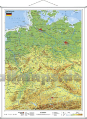
Puzzle-Spiele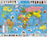
Landkartenpuzzles und viele andere Motive
Schicke Taschen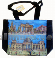
|


 Deutschland
