
Der Einkaufskorb ist noch leer.
|
Whanganui Journey Map & Whanganui National Park 1:50.000 + Track Guide Wanderkarte - Neuseeland Geographx - Craig Potton Publishing Neuseeland
|
Stöbern
|
<< Neuseeland
<< Potton & Burton / Craig Potton Publishing
|
|
 | |
Whanganui Journey Map & Whanganui National Park 1:50.000 + Track Guide Wanderkarte - Neuseeland Geographx - Craig Potton Publishing Neuseeland
ISBN: 0000000000
Preis: EUR 24.90
(incl. MwSt.)
|
|
 Blattschnitt Blattschnitt
The Whanganui River winds its way from the mountains to the Tasman Sea through countless hills and valleys. This journey lets you take a multi-day canoe or kayak trip to experience its most remote scenic beauty, history and cultural significance.
The Whanganui Journey passes through Whanganui National Park, in the south-west of the North Island, and is very accessible from State Highway 4 (SH4). Choose a 5 day journey from Taumarunui to Pipiriki (145 km), or a shorter, 3 day journey starting at Whakahoro (87 km), featuring the most scenic stretches of the river.
Features:
- Taumarunui to Whakahoro 3D Map on Front - Whakahoro to Pipiriki 3D Map on reverse
- 145 km and 203 rapids of grade 1 and 2 canoeing
- Award-winning relief mapping
- Printed on waterproof, durable, environmentally sustainable `Rockstock` paper. Kartenbeispiel aus der Serie
|
|
Startseite
Allgemeine Geschäftsbedingungen
Kontakt
Impressum
|
|
Dieser Sitzball ...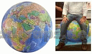
... ist ein detaillierter Globus
Die Welt ist ein Geschenkpapier
Riesengloben zum Aufpusten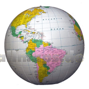
So entdecken Kinder die Welt.
Wandkarten fürs Büro und fürs Heim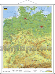
Die Welt aus dem All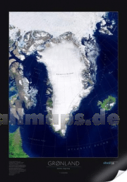
Dekorative Satellitenbild-Poster in gestochen scharfer Auflösung!
Puzzle-Spiele
Landkartenpuzzles und viele andere Motive
Schicke Taschen
|


 Deutschland
