 | |
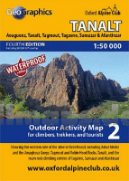
2: Tanalt - Aouguenz - Tanalt - Tagmout - Tagzene - Samazar - Afantinzar 1:50.000 GPS - wasserfest Outdoor Activity Map for climbers, trekkers and tourists - Climb Tafraout - minimap - Oxford Alpine Club
ISBN: 0000000000
Preis: EUR 14.90
(incl. MwSt.)
|
|
 Blattschnitt Blattschnitt
Beispiel
new GPS edition of our popular 1:50000 scale outdoor activity map of the western side of the Jebel el Kest massif, including Adrar Medni and the Amaghouz Gorge, Tagmout and Robin Hood Rocks, Tanalt, and the main rock climbing centres of Tagzene, Samazar and western Afantinzar.OAC MiniMaps are the most detailed and accurate maps currently available for Morocco`s Anti-Atlas mountains near Tafraout. These 1:50000 scale maps are drawn in a similar style to British OS maps, and are ideal for all outdoor activities in the Anti-Atlas region, including hillwalking, climbing, and scrambling, as well as exploring the region by car or bike. The Anti-Atlas range is covered by 4 miniMap sheets as follows: Sheet 1: Jebel Taskra massif, showing the Tizi N`Takoucht escarpment from Idaougnidif to Taskra, including the Kasbah Tizourgane and Aouguenz road. Sheet 2: Tanalt, showing the Amaghouz Gorge, Tanalt, Tagzene, Tagmout, Samazar and western Afantinzar. Sheet 3: Ameln, showing the summit of Jebel el Kest, the Ameln Valley, Tarakatine Pass and the eastern escarpment of Sidi M`Zal. Sheet 4: Tafraout, showing the granite back-country including Aguerd Oudad and the Painted Rocks. Blattschnitte der Outdoor Activity Maps Blattübersicht aller Karten vom Oxford Alpine Club
|


 Deutschland


