
Der Einkaufskorb ist noch leer.
|
Cape Wrath Trail South XT40- Wanderkarte 1:40.000 Fort William to Strathcarron - Long Distance Walk - waterproof - HARVEY MAPS Großbritannien
|
Stöbern
|
<< Großbritannien: Wanderkarten, Radwanderkarten und MTB-Karten
<< Harvay Maps
|
|
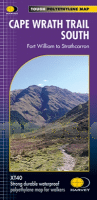 | |
Cape Wrath Trail South XT40- Wanderkarte 1:40.000 Fort William to Strathcarron - Long Distance Walk - waterproof - HARVEY MAPS Großbritannien
ISBN: 1851375341
Preis: EUR 22.90
(incl. MwSt.)
|
|
 Blattschnitt Blattschnitt
Beispiel
XT40 - Leap forward in technical excellence. Tough, light and 100% waterproof
Compact and light - the map itself weighs just 60gms - a third of the weight of a laminated map, and much less bulky. And you can fold or refold it time and again, or stuff it in your back pocket and it won`t fall to pieces. Shows the entire route on one sheet.
The Cape Wrath Trail is a challenging route from Fort William to Cape Wrath. It is around 200 miles long and passes through some of Scotland`s wildest and most spectacular scenery.
This map covers the southern section of the route, from Fort William to Strathcarron.
The trail has evolved from use and is not an officially recognised National Trail. There is no single definitive route. There are various ways of tackling the traverse all of which are highlighted on the maps leaving the actual route choice to the individual walker. This is rough country not to be underestimated. Some sections of the route will require an overnight stop in the mountains. This will either have to be wild camping or the use of a bothy. The bothies are also shown on the map.
|
|
Startseite
Allgemeine Geschäftsbedingungen
Kontakt
Impressum
|
|
Dieser Sitzball ...
... ist ein detaillierter Globus
Die Welt ist ein Geschenkpapier
Puzzle-Spiele
Landkartenpuzzles und viele andere Motive
Riesengloben zum Aufpusten
So entdecken Kinder die Welt.
Schicke Taschen
Wandkarten fürs Büro und fürs Heim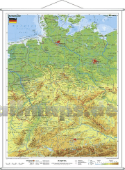
Die Welt aus dem All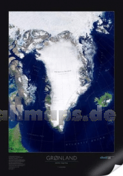
Dekorative Satellitenbild-Poster in gestochen scharfer Auflösung!
|


 Deutschland
